Jason VanHorn Discusses the Future of GIS: 7 Careers in Geographic Information Science
| 16 Min Read
There are not typically many people talking about geographic information science, or GIS, and that’s interesting — because it’s everywhere and in every industry. However, Professor Jason VanHorn, PhD, Director of the Master of Science in GIS online program at Calvin University, sees a burgeoning interest in the field.
“What I consistently hear among my students, who are often taking my course as juniors or seniors, is, ‘This is the coolest thing ever!” he said. “They will audibly say that in the lab. Then they’ll add, ‘If I just would’ve found this as a freshman or a sophomore, I would’ve gone down this path.’ I let them know that they can still pursue this. There are pathways for them to graduate as an undergraduate and then continue this work because they can take the passion they have for GIS and apply it in their industry.”
That’s what many students who go through the GIS program at Calvin do. GIS is an exciting discipline to study because the skills learned can be used to make a difference in almost any realm graduates decide to apply it. Dr. VanHorn’s path to his position was anything but straightforward. He brings his appreciation for combining passion, technology, and societal needs into a well-rounded career into his work at Calvin.

One Man’s Path to a GIS Career
Dr. VanHorn went to Indiana University as an undergraduate. After many attempts at different majors, he asked himself, Well, what do I really love? He recalled that he had done an occupational report in seventh grade, and the job he had chosen to investigate was cartographer. “It was like a revelation when I remembered that. In the American system of education, you generally find geography only as part of a history or social science course or maybe a government course. So I really didn’t have that emphasis in the K – 12 environment. But as an undergraduate having this recollection, I suddenly said, ‘Oh, that’s what I’m all about.”
He looked into whether or not his college offered geography as a focus. Sure enough, they had geography and a digital cartography track. He signed up, and within five minutes of his first course, he knew he had found his place and his people. He completed a double major in geography and political science.
Then, Dr. VanHorn spent five years in campus ministry. During that time, he fell in love with teaching. He had experience teaching as an undergraduate instructor in one of his courses. He had learned a lot about what it meant to teach his peers and think about different ways of evaluating and educating people. “But it was really in ministry, where I was working with both small and large groups, that I got a great opportunity to teach,” he explained. “So, when that time ended after five years, I was asking friends and family who knew me well, ‘What should I do next?’ They said, ‘Well, you love geography and teaching. You really need to go for your PhD and be a professor.’ So, that’s what I did.”
Focusing on geography and specializing in GIS, Dr. Van Horn earned his master’s degree from Texas A&M University. Then, he went to Ohio State University, where he obtained his PhD in geography, working with Dr. Mei-Po Kwan, the foremost expert in GIS in the world. “She was my advisor, so that experience was very rich and deep for me,” he recounted. “And it was during those graduate years that I realized not only do I love to teach, but I love to go deep in research as well. And so those became my two great passions in geography.”
This path led VanHorn to Calvin University in 2007, where he became a professor of geography in the geo department, which comprises geology, geography, and environment. The school offers four different majors in the department, and students come from all kinds of places at the university to take GIS courses with Dr. VanHorn. “It’s just been a real joy and a privilege to find my place in what I’m doing for employment,” he said with a smile.
Leading GIS courses is so satisfying to Dr. VanHorn because of the many ways it can be used to address real issues. His students are not limited in what they can apply themselves to or the difference they can make. GIS and mapping technologies are used in nearly every industry. They’re applied in analysis, communication, information sharing, and problem-solving in various environments. Because industries cover many different locations and settings, GIS is helpful for finding solutions to issues in both natural and human environments.
How GIS Is Used to Solve Environmental Problems
One of the most obvious areas that GIS is relevant is solving environmental challenges. Whether specialists focus on large-scale issues related to the environment, such as patterns of climate change and the spread of wildfires, or more local issues with a narrower scope, such as the spatial dimensions of a regional salmonella outbreak, GIS provides foundational theory, skills, and methods to investigate all of those things to find a solution.
“When you think about GIS, it illuminates an array of problems ranging from simple to complex because everything and everyone has a geography and a space,” explained Dr. VanHorn. “So, spatial dimension means there are all kinds of opportunities for GIS cartography and geospatial technologies to help provide solutions in the world. We can use GIS to identify problems, monitor changes, manage events and data, do forecasting and prediction, help in the decision-making process, and understand trends.”
According to Geospatial World, GIS can assist in:
- Disaster management: GIS can be used for early warning systems, modeling, and disaster response.
- Air quality: Through monitoring, analytics, and planning, corrective action can be taken and warnings can be made.
- Forest fire management: GIS is used for hazard map production and simulation.
- Managing natural resources: GIS can help address environmental issues like soil erosions, drought, earthquakes, and more.
As environmental issues progress, professionals with experience in GIS and mapping technologies can play a pivotal role in protecting our environment and society. “GIS provides kind foundational theory and skills and methods to investigate all of those things toward a solution,” said Dr. VanHorn.
GIS Applications in Anti-Terrorism Work
The use of GIS in operations to stop terrorist activity is all about protecting people in a defined area. It can be used to do many impactful things, from mitigating an event that has just happened or is in progress, such as countering terrorism, to participating in fighting against it and stopping it before it happens, known as anti-terrorism.
“In my work — which I also bring right into the classroom for my intro course and advanced courses — we’re often looking at the historical record of terrorism incidents in a particular place,” said Dr. VanHorn. “Let’s choose Madrid, Spain, for example. Let’s look at the historical events of the political violence in the city and map those incidents.”

Through that exercise, he and his students can examine not only the spatial but also the temporal dimensions of when terrorist attacks occurred. Furthermore, they can do something that Dr. VanHorn said is often very difficult, which is the descriptive work of what happened. “How many people lost their lives? How many people were injured? What are the other specific details related to that incident? All of that is linked to a geography in space and time. Using GIS gives us that knowledge and enables us to analyze the data as points on a map associated with time. Then, we can ask questions in order to understand more about the historical context of what occurred and the spatial dimensions of the phenomena, so that we can think about protecting people in place now and in the future.”
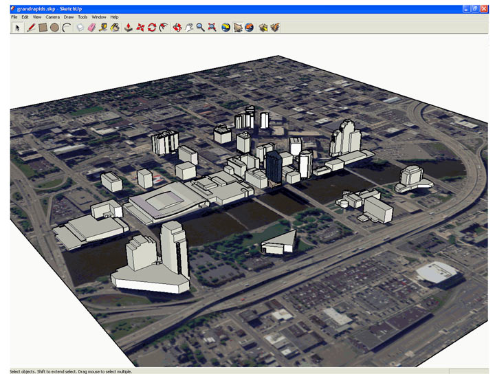
Dr. VanHorn’s work has explored large events as well. “One that occurred in his city was a huge celebration for one of our former presidents who was from the town and had passed away. It was a big VIP event, and thousands of people were going to descend on the city to attend,” he said. “My question was, can we use GIS to protect that event? Sure enough, what I did was I built a 3D analysis of the stage where the event was to occur. From there, I used view shed analysis that said, what are all places in a geography sense that can see that place? What are all places in the entire area that can see that place? [See image below for visual] Then, we’ve covered an entire framework of a geography, where agents who are tasked with protecting people in place have a spatial framework from which to work. That saves energy, that saves time, that saves in terms of costs.”
The opportunities for providing safety to society through GIS mapping are unlimited, leading professionals to have a plethora of job options in government agencies and other organizations committed to protection. “When you think about GIS and its use in anti-terrorism work, for me, it’s all about the protection of people in place. It can be used to really do all kinds of things, whether it’s mitigating an event that happens, such as trying to counter the terrorism, or participating in fighting against it before it happens,” explained Dr. VanHorn.
How GIS Aids in Business Decisions
Another interesting and expansive way GIS skills are used is in business decision-making. Dr. VanHorn thinks the link between the two is clear. “Business is linked to geography. We know that the mantra for real estate is location, location, location. That is inherently geography, geography, geography. When you think about business, it is spatial in every sense of the word. These items are coming from a place, they’re being manufactured in a place, and they have to come to market,” he explained.
Aside from the private market, there’s a huge potential for GIS to impact the nonprofit world that Dr. VanHorn thinks could help fill service gaps. “Nonprofit organizations offer different services. So, if we pick a program, let’s say an after-school program, we can look at all the nonprofits in the city that have after-school programs,” he said. “And then what we can do is we can ask where are the gaps? Where are the overlaps? Where might we encourage another nonprofit or expand the nonprofit’s capacity with the existing businesses to offer those services in those gaps. All kinds of possibilities exist with thinking spatially.”
Dr. VanHorn feels the link between business and GIS is vast and deep, not just when it comes to the location of storefronts, but manufacturing, merchandising, event planning, and how organizations look at their target markets. He believes the possibilities will only continue to grow. “I feel we are just at the precipice here of really exploding in this area.” He’s developed a new course that explores things like market penetration and location allocation.
These industry areas are just a taste of where students can apply their skills to grow interesting and lucrative careers. GIS is used in almost every field, from programming to agriculture to healthcare. The possibilities of the impact to be made with strong educational skills are endless.

Qualities to Help Specialists Effect Change in a GIS Career
As Dr. VanHorn pointed out, GIS aids in many tangible and vital ways. When pursuing a role in GIS, professionals align their passions with their technical skills. Certain qualities make a huge difference when building a truly impactful career. Some that help GIS specialists succeed include:
- Curiosity: GIS professionals work with changing technology and applications. A passion for learning is necessary to ensure that they don’t fall behind in the industry and adapt to changes.
- Logic: A GIS specialist in any industry will face many analytical issues. The ability to think logically and determine the important information is key.
- Eloquence: Those working with GIS in their careers often have to communicate complex issues in a way that makes sense to non-experts. Excellent communication skills that hold others’ attention will help them succeed.
- Decisiveness: GIS technicians can work in a variety of high-stress careers where making decisive calls is necessary. Being able to view information and choose a path of action will aid in success.
These qualities, coupled with an understanding of GIS, will serve professionals well, no matter what path they choose. According to Dr. VanHorn, adding the skills learned in his program to an already impressive list of traits helps candidates shine in the employment marketplace.
“Not only do GIS skills make you more marketable and definitely attractive to those employers, they give you a specific skill set to answer questions that others just cannot.”

Growing GIS Careers That Make an Impact
There are numerous types of GIS jobs, and many are growing at a rapid pace. Dr. VanHorn sees opportunity everywhere. “GIS and mapping technologies are used in nearly every industry,” he explained. “It’s used for analysis and communication. It’s used for information sharing and solving problems in various environments. Because industries cover a whole bunch of different environments, GIS is helpful for solving problems in both the natural environment, but also human environments as well.”
Students with a background in GIS pursue jobs as scientists and analysts in a variety of in-demand roles at companies working in anti-terrorism, environmental science, and business, along with many others. Here are a few of the roles GIS experts occupy across industries:
According to the Bureau of Labor Statistics (BLS), “Geographers use several technologies in their work, such as GIS, remote sensing, and global positioning systems (GPS). Geographers use GIS to find relationships and trends in geographic data. These systems allow geographers to present data visually as maps, reports, and charts.”
The BLS reported geographers made a median salary $85,430 in 2020 and worked in a variety of settings, including the federal government, educational services, local governments, and in professional and technical roles.
The field of market research is exploding, and GIS skills could help graduates stand out from the competition. Market research analysts use their knowledge to explore the potential of products and services. According to the BLS, the field will grow 22% by 2030.
The BLS stated, “Market research analysts evaluate data using statistical techniques and software. They must interpret what the data mean for their client, and they may forecast future trends. They often make charts, graphs, infographics, and other visual aids to present the results of their research.” Clearly, GIS can play a big role in these endeavors.
A cartographer collects and interprets geographic information to create maps and charts for planning and education purposes. According to the BLS, cartographers work for the federal government, where they made a median salary of $92,650 in 2020. Cartographers also work for state and local governments, as well as in consulting firms and for architectural and engineering businesses.
The BLS stated, “GIS technology is typically used to assemble, integrate, analyze, and present spatial information in a digital format. Maps created with GIS technology combine spatial graphic features with data.”
Another career where GIS plays a prominent role is geoscience. Geoscientists study the physical aspects of Earth. Many geoscientists use GIS technology and other modeling software in their data collection and to make the maps and charts necessary in scientific reports and presentations.
The BLS reported that in 2020, geoscientists made a median pay of $93,580. Geoscientists work at architectural and engineering firms, mining companies, and various government agencies.
Data scientists are needed in almost every industry and get paid well for their work. Spatial data scientists specifically benefit from being experts in GIS because they focus on modeling data in terms of space. They work with big data, using it to answer questions with a geospatial component.
The BLS reported that the median annual wage for data scientists in 2020 was $103,930, with the top 10% making more than $165,000 per year. Data scientists work in scientific and technical industries, as well as for major businesses and government organizations.
Environmental scientists work to protect the environment and human health through collecting data for various research projects, analyzing information to determine environmental threats, and providing guidance to businesses and governments. Environmental scientists develop reports and presentations to ensure their findings are well understood and useful and advise on climate change, environmental restoration, and public health.
They work in a variety of scientific and consulting jobs, as well as for state, local, and federal governments. According to the BLS, environmental scientists made a median salary of $73,230 in 2020, and the field is expected to grow 8% by 2030.
Surveyors work to make precise boundary lines and plan property. They work for the government, mining and oil and gas companies, construction firms, and architectural and engineering companies. In 2020, the top 10% of surveyors earned more than $109,010, according to the BLS.
The BLS stated that GIS technology is used heavily in surveying. “A surveyor can overlay aerial or satellite images with GIS data, such as tree density in a given region, and create digital maps. They then use the results to advise governments and businesses on where to plan homes, roads, and landfills.”
Dr. VanHorn knows there’s no limit to what can be achieved with GIS technology and knowledge. “GIS provides foundational theory and skills and methods to investigate things toward a solution,” he said. “When we think about the opportunities that GIS provides for us to answer these questions about the environment, it can be natural and human in its framework, because all of those share a common reality of a geography.”

Be on the Cutting-Edge of GIS Technology
As Dr. VanHorn illustrates with his career, the impact to be made with GIS skills spans many specialties and industries and will only continue to grow as new minds think of game-changing applications for it in the real world.
To build skills in GIS, consider a program from Calvin University. Led by Dr. VanHorn and other enthusiastic expert faculty, the online MS in Geographic Information Science prepares students to conduct geographic research and examine information in the context of culture and history. Graduates give back to their communities in diverse ways and keep on the forefront of technology.
Regardless of your chosen GIS career path, Calvin’s program will provide you with the advanced skills and hands-on technology experience needed to achieve your goals. Students graduate from the program with a variety of competencies, including:
- Navigating sophisticated and emerging technology in the field of geographic information science, including GPS software and drones.
- Collecting, using and examining census data in the context of culture and history.
- Designing and maintaining geospatial databases.
To ensure online students receive a hands-on educational experience, the program features a virtual lab component that allows them to train on drones for remote sensing and learn state-of-the-art techniques while working with modern software.
In addition to ensuring students have the technical knowledge they need to succeed, the faith-based program asks learners to consider deep questions about what they are studying and how it can impact that world for its betterment. With a field like GIS, the possibilities are unlimited.
To learn more, please fill out the form located here or call 616-200-4403.